AAAI-26 · 2026
One Map, Many Trials
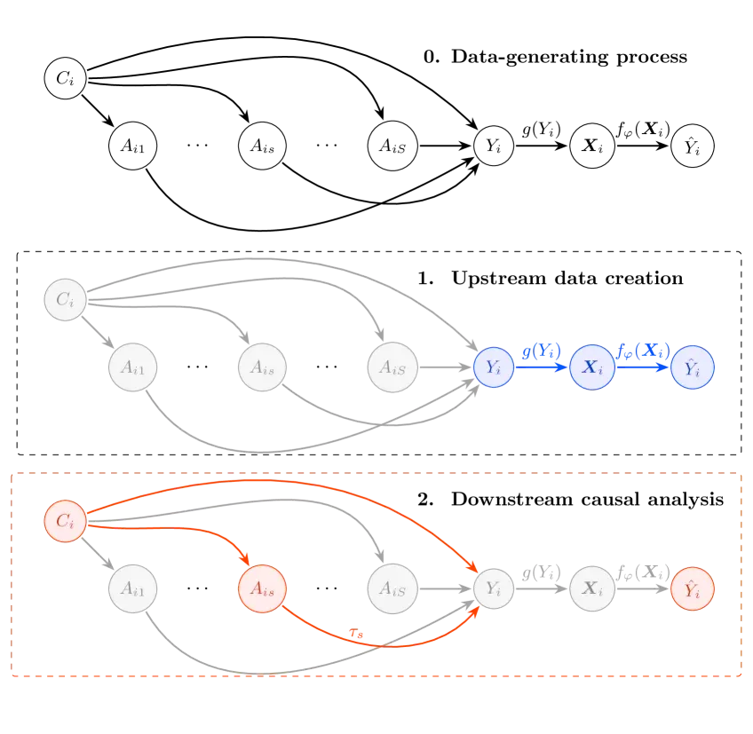
Satellite-driven poverty mapping is powerful — and biased. This work focuses on debiasing model predictions for causal inference when additional ground truth labels are scarce.
Remote sensing
Debiasing
Causal inference
Poverty mapping
The idea
Debiasing predictions for causal inference
In high-stakes settings, prediction accuracy is not enough: the goal is to estimate effects and understand uncertainty. “One Map, Many Trials” frames a path to use satellite-based predictors while controlling for bias that can distort causal conclusions.
Where does bias enter?
What can we fix without new labels?
How do we evaluate?
Visual